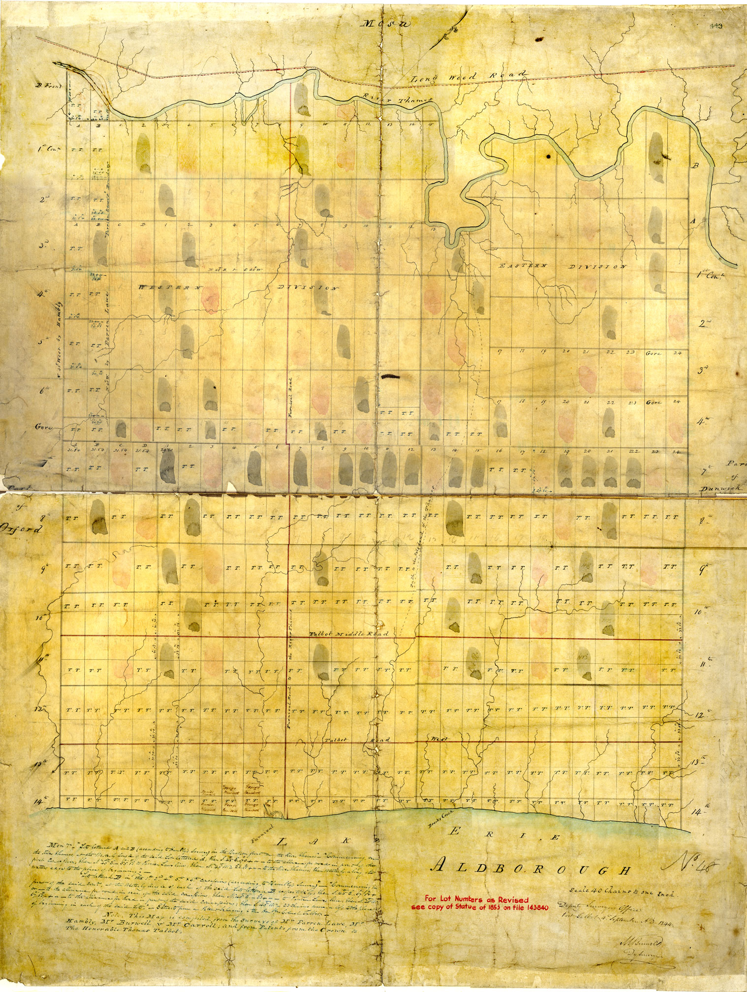
Talbot Settlement and Survey Maps, 1793-1849:
The survey and settlement maps are two separate collections that detail the early geography and settlement patterns of the Talbot tract, a stretch of land along the north shore of Lake Erie.

The survey and settlement maps are two separate collections that detail the early geography and settlement patterns of the Talbot tract, a stretch of land along the north shore of Lake Erie.
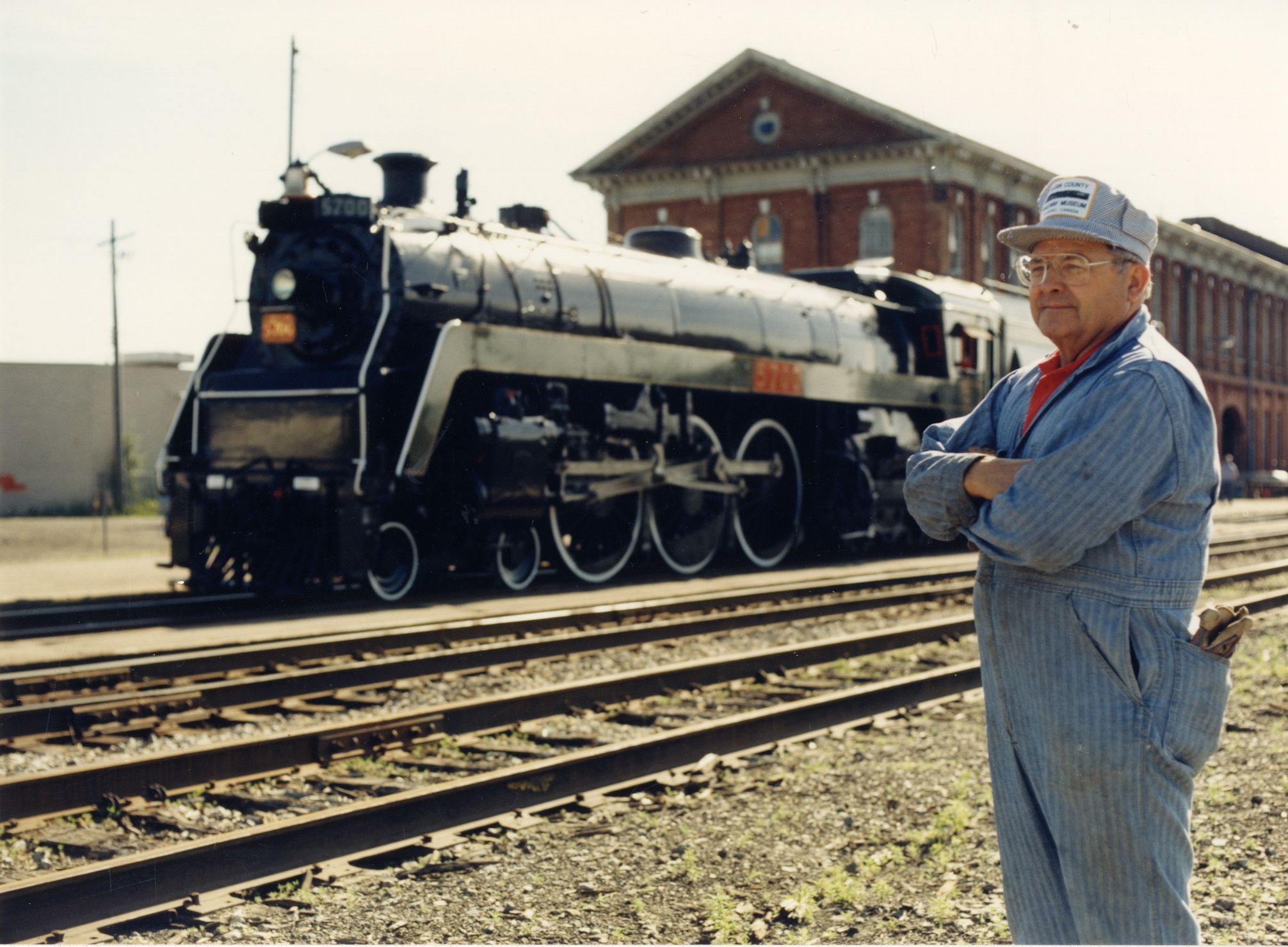
Are you a railway enthusiast? We are currently processing the collection of the late Ken Verrell and have recently added over 1500 photographs of trains and locomotives to our online database.
Former Elgin County Warden Dave Rock has donated to the Archives a large collection of documents, photographs and research files documenting the history of the…