The Thomas Talbot Fonds, F 501
History
Colonel Thomas Talbot (1771-1853) was a prominent military man and colonizer in Upper Canada. He became Lieutenant-General Simcoe’s secretary in 1792, and in this role, travelled around Upper Canada. He left Simcoe’s staff by 1794, resigned his commission in 1800, and from there began farming at the mouth of Kettle Creek. In 1803, he received a land grant of 5000 acres from the Crown in Dunwich and Aldborough townships (then part of Middlesex County), with the promise of populating it with British settlers.
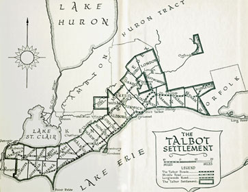
A large territory, eventually stretching from Sandwich Township, at the Detroit River, to Middleton Township in Norfolk County, for which Talbot became the Crown Land Agent, would become known as the Talbot Settlement. In his role as District Road Commissioner, he had the Talbot Road (part of former Highway 3) and the Longwoods Road (part of former Highway 2) laid out, greatly assisting settlement in the area.
Known for being selective in choosing settlers, Talbot would pencil in names on the large-scale plans he used, and would sometimes reclaim Crown land for non-completion of settlement duties (clearing land and building a log house) by simply erasing names. To complicate matters, Talbot did not register any of his grants with the Surveyor General’s office, so his maps were the only reference available, which he sought to keep in his control.
The end of his career came about after he made political demands on the settlers, a contributing factor to the 1837 Rebellion, and had his superintendency cancelled by the following year, with the land turning over to the province. His personal records, which were the only record of settlement in the Talbot Settlement and were needed to determine which settlers had completed their settlement duties, would not be turned over to the Department of Crown Lands until his death in 1853.
Description
The Thomas Talbot fonds includes 45 large-format plans (registered 1802-1832; incorporating annotations dated 1810-1849) and a lease settlement register (created and maintained 1842-1846; includes retroactive entries dated 1825-1836) documenting land distribution in the town of London and the 30 townships in six counties throughout southwestern Ontario in which Talbot controlled land allocation. The plans show survey grids, clergy and school reserves, town sites (including London), First Nations villages, mill seats, footpaths, trails, waterways and crossings, local and regional roads. Most significantly, perhaps, the plans include personal land settlement information, with the names of grantees and dates of occupation penciled in by Talbot on individual lots.
A note on dating the maps: in many cases, Talbot treated them as working documents, adding, removing, overwriting and revising annotations, often over a period of several years, and, in a few instances, including information retroactive to the creation of the document. For example, item F 501-1-0-0-18 was registered in 1824, but incorporates annotations dated 1817-1840. 34 of the plans have been registered, and their registration dates have been adopted as a "date of creation". 10 plans bear no registration date, but do incorporate dated annotations: in the absence of other evidence, the earliest and latest dated annotations in these plans have been adopted as representing the plan's temporal scope. One plan (F 501-1-0-0-38) contains no dated data and has been assigned an estimated date based on internal evidence and comparison with related plans.
The Elgin County Branch of the Ontario Genealogical Society Branch has provided invaluable assistance in creating indexes to property holder names and occupied/granted properties shown in the plans. The indexing of the maps is a work in progress: as individual map indexes become available, this will be indicated in the table below with the presence of the camera icon which will serve as an active link to the PDF format index file.
The table can be rearranged, alphabetically, by clicking either the “Township” header or the “County” header. Clicking once will arrange it from A to Z; clicking a second time will arrange it from Z to A. By default, the table is sorted alphabetically by township name.
Township  |
County |
Reference # (Link to descriptive record) |
Date of Registration (R) or Annotation (A) | Digitized Plan (PDF) |
Index of Property Holders (PDF) |
Index of Occupied/Granted Properties (PDF) |
|---|---|---|---|---|---|---|
| Bayham | Elgin | F 501-1-0-0-1 | 1811-1817 (A) |
|
||
| Bayham | Elgin | F 501-1-0-0-2 | 1810-1839 (A) |
|
||
| Blandford | Oxford | F 501-1-0-0-3 | 1826 (R) |
|
||
| Caradoc | Middlesex | F 501-1-0-0-4 | 1821 (R) |
|
||
| Ekfrid | Middlesex | F 501-1-0-0-7 | 1820 (R) |
|
||
| Gosfield | Essex | F 501-1-0-0-8 | 1832 (R) |
|
||
| Harwich & Howard | Kent | F 501-1-0-0-10 | 1816-1817 (A) |
|
||
| Houghton | Norfolk | F 501-1-0-0-11 | 1814 (R) |
|
||
| Houghton | Norfolk | F 501-1-0-0-12 | 1819 (R) |
|
No indexable data | No indexable data |
| Houghton | Norfolk | F 501-1-0-0-13 | 1823 (R) |
|
||
| Howard | Kent | F 501-1-0-0-14 | 1816 (R) |
|
||
| Howard | Kent | F 501-1-0-0-15 | 1824 (R) |
|
||
| Howard & Orford | Kent | F 501-1-0-0-9 | 1811 (R) |
|
||
| London (Township) | Middlesex | F 501-1-0-0-16 | 1818 (R) |
|
||
| London (Town) | Middlesex | F 501-1-0-0-17 | 1826 (R) |
|
||
| Maidstone & Rochester | Essex | F 501-1-0-0-19 | 1826 (R) |
|
||
| Maidstone, Rochester & Sandwich | Essex | F 501-1-0-0-18 | 1824 (R) |
|
||
| Malahide | Elgin | F 501-1-0-0-20 | 1816-1837 (A) |
|
|
|
| Mersea | Essex | F 501-1-0-0-21 | 1816 (R) |
|
||
| Mersea | Essex | F 501-1-0-0-22 | 1827 (R) |
|
||
| Middleton | Norfolk | F 501-1-0-0-5 | 1814 (R) |
|
||
| Middleton | Norfolk | F 501-1-0-0-23 | 1816-1817 (A) |
|
||
| Middleton | Norfolk | F 501-1-0-0-24 | 1818-1819 (A) |
|
||
| Mosa | Middlesex | F 501-1-0-0-25 | 1820 (R) |
|
||
| Orford | Kent | F 501-1-0-0-26 | 1825 (R) |
|
||
| Raleigh | Kent | F 501-1-0-0-27 | 1811 (R) |
|
||
| Raleigh | Kent | F 501-1-0-0-28 | 1816-1817 (A) |
|
|
|
| Raleigh | Kent | F 501-1-0-0-29 | 1826 (R) |
|
||
| Romney | Kent | F 501-1-0-0-30 | 1811 (R) |
|
||
| Romney | Kent | F 501-1-0-0-31 | 1832 (R) |
|
||
| Sandwich | Essex | F 501-1-0-0-32 | 1826 (R) |
|
||
| Southwold | Elgin | F 501-1-0-0-6 | 1810 (R) |
|
||
| Southwold | Elgin | F 501-1-0-0-33 | 1819 (R) |
|
||
| Southwold | Elgin | F 501-1-0-0-34 | 1816-1819 (A) |
|
||
| Tilbury East | Kent | F 501-1-0-0-35 | 1832-1843 (A) |
|
||
| Tilbury West | Essex | F 501-1-0-0-36 | 1826 (R) |
|
||
| Westminster | Middlesex | F 501-1-0-0-37 | 1811 (R) |
|
||
| Westminster | Middlesex | F 501-1-0-0-38 | ca. 1810 |
|
No indexable data | No indexable data |
| Westminster | Middlesex | F 501-1-0-0-39 | 1823 (R) |
|
||
| Yarmouth | Elgin | F 501-1-0-0-40 | 1802 (R) |
|
|
|
| Yarmouth | Elgin | F 501-1-0-0-41 | 1816 (A) |
|
|
|
| Yarmouth | Elgin | F 501-1-0-0-42 | 1814 (R) |
|
|
|
| Yarmouth | Elgin | F 501-1-0-0-43 | 1819 (R) |
|
||
| Yarmouth | Elgin | F 501-1-0-0-44 | 1823 (R) |
|
||
| Zone | Kent | F 501-1-0-0-45 | 1818-1840 (A) |
|
||
| Talbot Settlement Lease Book | N/A | F 501-2 | 1842-1846 |
|